Maps
The following five Ordnance Survey maps and one aerial photograph show Deane Road cemetery and its surrounds over a period of approximately 154 years, from its rural beginnings in the 19th century, through the urban 20th century and to the attempted reclamation of the land by nature in the 21st century.
1. 1851

This map shows just how rural the Kensington area was, prior to its development in the 1880s and 1890s. Deane Street had yet to have its name changed to Deane Road and much of the area to the west of it was still untouched. It is very difficult to imagine today that the cemetery really was originally situated well outside the city, amongst open fields and wildlife.
2. 1893

This map shows trees within the cemetery grounds, and most of these were identifiable prior to the clean-up days held at the cemetery in 2006. The path is shown, and the new path, laid c.1997, follows this route exactly. The ohel (prayer hall, top) and cottage (bottom) are depicted at the entrance to the cemetery, separated by an open space. The small item apparently protruding into this open space from the wall of the cottage may have been a fixed washbasin of some kind.
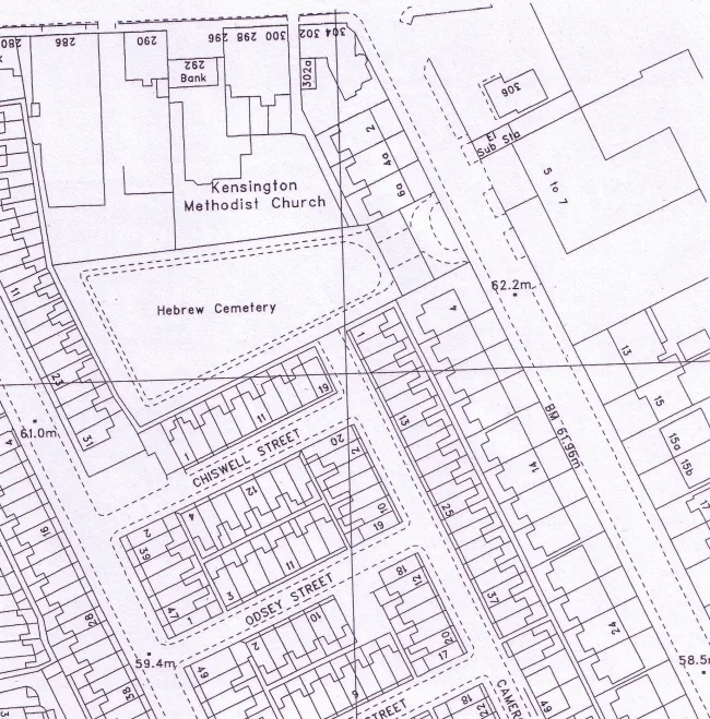
3. 1908

By this time, the cemetery had stopped being used for regular burials, but some reserved plots were still being filled. The cemetery area is covered in much less detail here: the path and trees are not shown, but the buildings remain. The cluster of smaller structures in the corner of the cottage area is thought to be toilets.
4. 1927

On this map, the path is shown once more, and the words “Mortuary Chapel” are included. These must have referred to the ohel, as the word mortuary is included in one of the headings in one of the cemetery’s burial registers. Two trees are marked in the driveway of the cemetery, although only one tree, centrally placed, stood there for muchof the 20th century.
5. c.2002
This is the most recent Ordnance Survey map of the cemetery, and it shows the path and the driveway, along with dotted lines to show the former position of the ohel and cottage, which were demolished in 1952.
6. 2005

Although this great image from Google Earth is not a map of the cemetery, it is an aerial view which complements the above maps perfectly. The amount of foliage is clear to see, especially the dense “jungle” area toward the north-west corner.